I am so lucky to get the chance to visit Mount. Bromo before the eruption. This opportunity came, when I have such a reckless and foolish idea to bring my family for a road trip around the Java Island on September 2010, starting from Jakarta to Semarang, Surabaya, Malang, Turen, Solo, and then adventure ended in Yogyakarta, then we went back home to Jakarta. We spent 5 days for the whole experienced trip.
It took about 1 hr and 30 min to reach near the top of Mount. Bromo from Surabaya. You have to pass such a dark spooky uphill road to reach our lodge. We were checking several places for an over night stay when we finally found Hotel Yoschi Bromo in a very edge of our hopes hunt, owned by the Japanese.
It took about 1 hr and 30 min to reach near the top of Mount. Bromo from Surabaya. You have to pass such a dark spooky uphill road to reach our lodge. We were checking several places for an over night stay when we finally found Hotel Yoschi Bromo in a very edge of our hopes hunt, owned by the Japanese.
Mount. Bromo has smartly stolen my heart through every angle of landscapes and the story beyond it. It is one of tourist most popular destination in East Java which is located in the Bromo Tengger Semeru National Park in the eastern city of Malang.
Cold windy and mysterious was the first impression of this place that catched my mind. The temperature at night was around 5 degrees Celsius and 0 degrees Celsius during the morning. Luckily I brought my long thick black coat that I could used the next day on our ride to see the sunrise from the peak. We all went to bed early so we will not missed the sunrise views which famous among the tourist. I made a car reservation and asked them to pick us at the hotel at 03.00 AM.
 |
| Yoschi Bromo |
 |
| View from our hotel ^^ |
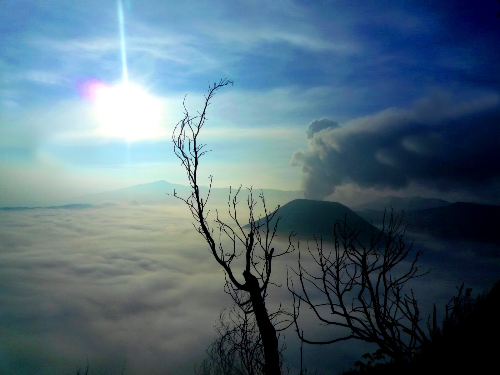
Standing at an altitude of 2770 meters of Mount Penanjakan, was a new experience for me. The tracks must be passed by a Jeep car, it was a heavy track. As the sun began to reveal itself completely, I began to prepare my camera to capture those beautiful moments. The sun emerged from just a tiny speck of ray light, dazzling my eyes and my heart; I was really intrigued by the very natural composition of colors and scenery of Mount .Bromo and the peeked of the sun. The cold atmosphere was so perfect, adding such a romantic lust for couples. Mount. Bromo was surrounded by thick white smoke billowing above its rose more clear in visiblity.
 | |
| When the sun rise right behind the mount, it's just wonderful |
 | |
| Taken from distance on the other side of the hills |
The peak of Mount Bromo is one of the most tourist visits. You have two options to get there by a horse or take a long walk, climbing hundreds of steep stairs. I was thinking a little bit of doing physical exercise so I climbed the stairs to the top which was such a big challenge to me, with great difficulty and the smell of sulfur that tighten my chest. I thought I was almost there, but when I looked up, it was a long and increasingly steep terrain. Several times I had to stop to gathered strength and catched my breath and recharged a zip of power for my legs, as well as other climbers, hikers. But this was not in vain; my heart whispered to me “when can you come here again? May be not in the near time”. And there was I!
 |
| Right here is a closer look to the crater |
Was not completed until there, I saw the other side of Bromo known as The Sea Sand (Lautan Pasir), the place had been used for filming the big screen ‘Pasir Berbisik’ that played by Dian Sastrowardoyo and Christine Hakim. The journey to get there surrounded by a sea of desert, grasses and lined valleys. Awesome!
 |
| A lion rock in the overlay desert |
Arriving in The Sea Sand unimaginable by your mind and unspeakable by your mouth, it was too beautiful to believe such place are here in Indonesia. I felt like being stranded on a fascinateing stretch of desert surrounded by valleys and limestone, that makes me felt like surrounded by mountains of snow. Our guide also showed us a big stone shaped like a lion. The stone just grabbing my attention and added a strong mystical impression.
The hunger began to whack, which was signed to end my day in Mount Bromo, took lunch and immediately went to the next place. Although it feels very less time for me to enjoy this beautiful place, but I was pleased to have the opportunity to come and got one of the most beautiful incredible sunrise that I’ve ever had in my life.
The hunger began to whack, which was signed to end my day in Mount Bromo, took lunch and immediately went to the next place. Although it feels very less time for me to enjoy this beautiful place, but I was pleased to have the opportunity to come and got one of the most beautiful incredible sunrise that I’ve ever had in my life.
 |
| Surrounded by beautiful view |
 |
| Our Jeep in Bromo |
 |
| Beautiful Views from Every Angle |
Getting there is not very complicated, either by plane to Surabaya or to Malang, or you can travel by road.
Calculate My Budget
Gasoline IDR 600.000 (Jakarta - Surabaya by Car) @ person = IDR 120.000
Tol & Parking IDR 100.000 @ person = IDR 20.000
Accommodation IDR 300.000 / room for 4 - 5 person = IDR 50.000
Meal = IDR 100.000
Rent 4WD Jeep IDR 300.000 @ person = IDR 60.000
Others = IDR 200.000
TOTAL = IDR 550.000 / -/+USD 65
Suggestions
- Don't missed the morning rise
- Bring thick cloths, gloves and hat/cap
- Make it possible to reach Bromo before evening
- Go up to the lava pit
- If you wanna drive to the venue by your own car, use a 4WD vehicle
Information About Bromo (wikipedia)
Mount Bromo (Indonesian: Gunung Bromo), is an active volcano and part of the Tengger massif, in East Java, Indonesia. At 2,329 metres (7,641 ft) it is not the highest peak of the massif, but is the most well known. The massif area is one of the most visited tourist attractions in East Java, Indonesia. The volcano belongs to the Bromo Tengger Semeru National Park. The name of Bromo derived from Javanese pronunciation of Brahma, the Hindu creator god.
Mount Bromo sits in the middle of a vast plain called the "Sea of Sand" (Javanese: Segara Wedi or Indonesian: Lautan Pasir), a protected nature reserve since 1919. The typical way to visit Mount Bromo is from the nearby mountain village of Cemoro Lawang. From there it is possible to walk to the volcano in about 45 minutes, but it is also possible to take an organised jeep tour, which includes a stop at the viewpoint on Mount Penanjakan (2,770 m or 9,088 ft) (Indonesian: Gunung Penanjakan). The best views from Mount Bromo to the Sand Sea below and the surrounding volcanoes are at sunrise. The viewpoint on Mount Penanjakan can also be reached on foot in about two hours. From inside the caldera, sulfur is collected by workers.
On the fourteenth day of the Hindu festival of Yadnya Kasada, the Tenggeresecaldera of the volcano. The origin of the ritual lies in the 15th century legend where a princess named Roro Anteng started the principality of Tengger with her husband, Joko Seger. The couple were childless and therefore beseeched the assistance of the mountain gods. The gods granted them 24 children but stipulated that the 25th child, named Kesuma, must be thrown into the volcano as human sacrifice. The gods' request was implemented. The tradition of throwing sacrifices into the volcano to appease these ancient deities continues today and called Yadnya Kasada ceremony. Though fraught with danger, some locals risk climbing down into the crater in an attempt to recollect the sacrificed goods that believed could bring them good luck. people of Probolinggo, East Java, travel up the mountain in order to make offerings of fruit, rice, vegetables, flowers and sacrifices of livestock to the mountain gods by throwing them into the
On the Segara Wedi sand plain sits a Hindu temple called Pura Luhur Poten. The temple holds a significant importance to the Tenggerese scatter across the mountainous villages such as Ngadisari, Wonokitri, Ngadas, Argosari, Ranu Prani, Ledok Ombo and Wonokerso. The temple organized annual Yadnya Kasada ceremony which lasts for about one month. On the 14th day, the Tenggerese will congregate at Pura Luhur Poten to ask for blessings from Ida Sang Hyang Widi Wasa and God of Mahameru (Mount Semeru). Then the mass will proceed along the crater edges of Mt Bromo where offerings will be thrown into the crater. The major difference between this temple with the Balinese ones are the type of stones and building materials. Pura Luhur Poten uses natural black stones from volcanoes nearby, while Balinese temples mostly made from red bricks. Inside this pura, there are several buildings and enclosures aligned in Mandala zone composition.
The Tengger Caldera was still active in late January 2011, the activity being characterised by fluctuating ongoing eruptions. On 23 January 2011 the Indonesian Centre for Volcanology and Geological Hazard Mitigation (CVGHM) (Pusat Vulkanologi dan Mitigasi Bencana Geologi) reported that since 19 December, 2010 volcanic ash and incandescent material had been thrown up by eruptive activity resulting in a heavy rain of material that fell around the crater. Continuous eruptions on 21 January caused a thin ash fall mainly in the village areas of Ngadirejo and Sukapura Wonokerto in Probolinggo district. The impact of a heavy rain of volcanic ash from eruptions since 19 December 2010 resulted in disruption of normal activities. By early 2011 concerns were being raised concerning the effect upon the local economy and the potential for long term environmental and health problems amongst the residents in the locality surrounding Mount Bromo. Due to high seasonal rainfall in January 2011 the potential for lahar and lava flow was raised due to the deposits of volcanic ash, sand and other ejected material that had built up. Seismic activity was dominated by tremor vibration and reports of visual intensity and sounds of eruption continued to be reported from the mountain monitoring facility, Bromo Observation Post. People living on the banks of the Perahu Ravine, Nganten Ravine and Sukapura River were alerted to the possibility of lava flows, especially when it was raining heavily in the area around Cemorolawang, Ngadisari and Ngadirejo. Eruptions and volcanic tremors were reported on 21 January and 22 January with activity subsiding on 23 January 2011. On 23 January, 2011 at 06:00 am the alert status at Mount Bromo remained at (Level III).
On 23 January 2011 an exclusion zone was recommended for communities living around Mount Bromo. Tourists and hikers were to advised not to come within a radius of 2 km from the active crater. CVGHM stated that they expected warning signs to be installed stating the limit radius of 2 km from the crater. Operational caution was recommended for flights into and leaving Juanda International Airport IATA: SUB in Surabaya. CVGHM recommended the establishment of public areas for the provision of face masks and eye protection. CVGHM also issued a warning to residents to be cautious of ash build up on roofs and other places that may give cause for collapse under the burden of ash.
Further eruptions and the issuing of Aviation Ash advisories on 27 January and 28 January 2011 led to concerns being raised regarding a volcanic ash plume, reported to be drifting eastward toward the air corridors used to access the Ngurah Rai International Airport IATA:DPS in Bali. Airport official Sherly Yunita was reported at the time as stating that concerns about visibility had prompted Singapore Airlines, Jetstar-ValueAir, Air France-KLM, Virgin Blue and Cathay Pacific to cancel several flights to Bali, 340 km (210 mi) to the east. SilkAir also cancelled flights on the 27 January between Singapore and Lombok, an island to the east of Bali.[11] The Volcanic Ash Advisory Centre in Darwin, Australia released several Code Red Aviation Ash Advisories pertaining to Mount Bromo (Tengger Caldera), on 27 January. They indicated that ash was observed at altitudes up to 18,000 ft (FL180) extending 200 nautical mi to the south east of the caldera. In other ash advisories of that day the cloud was reported as at times having a 10 km/h drift, both to the east, and to the south east